

market@chinacoalintl.com
The geophysical instrument uses the physical properties of groundwater such as benign conductivity, intensification effect, radioactivity and other physical properties to find information on the location, depth, water level and water output of groundwater. It is also commonly known as “water detector” and “water tester”. .
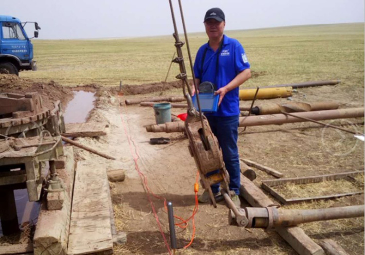
Drilling workers are using instrumentation to measure data
The principle of geophysical (water-seeking) instrument, using natural electric field as the field source, based on the electrical difference of underground rock ore (groundwater), the electric field is studied by measuring the variation law of electromagnetic fields generated by several different frequencies in the natural earth electromagnetic field. An electrical surveying instrument that solves geological problems by generating abnormalities from different geological bodies.
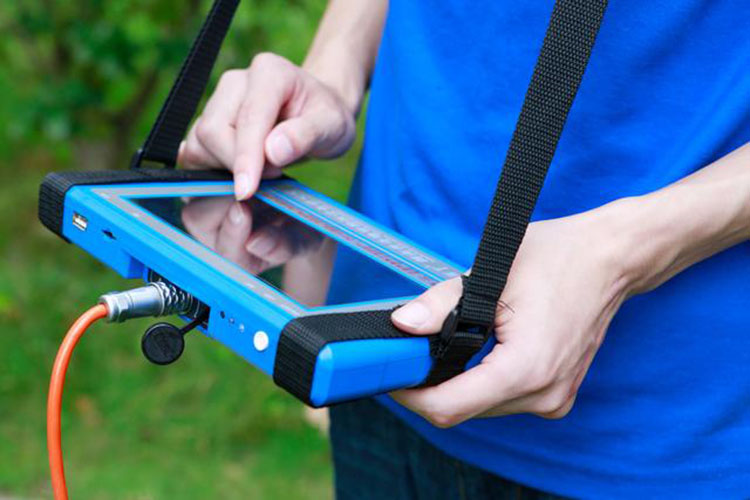
Drilling workers are using instrumentation to measure data
At present, there are two kinds of domestic geophysical water detectors. One is the MRI water detector. The price is relatively expensive. One is the commonly used natural electric field water detector. The price is close to the people. It is the helper of the well user and solves the dry eye for everyone. A common device for problems. Everyone usually refers to the well-drilling water meter. This is the underground structure analyzed by the instrument itself. The variable layer fracture zone does not see the amount of water. The underground structure is used to analyze the water-bearing conditions. The well-drilling users know the variable layer. The place is the best in terms of water content, and combined with the personal geological experience and the consent analysis of the local geological conditions, to determine the amount of water.
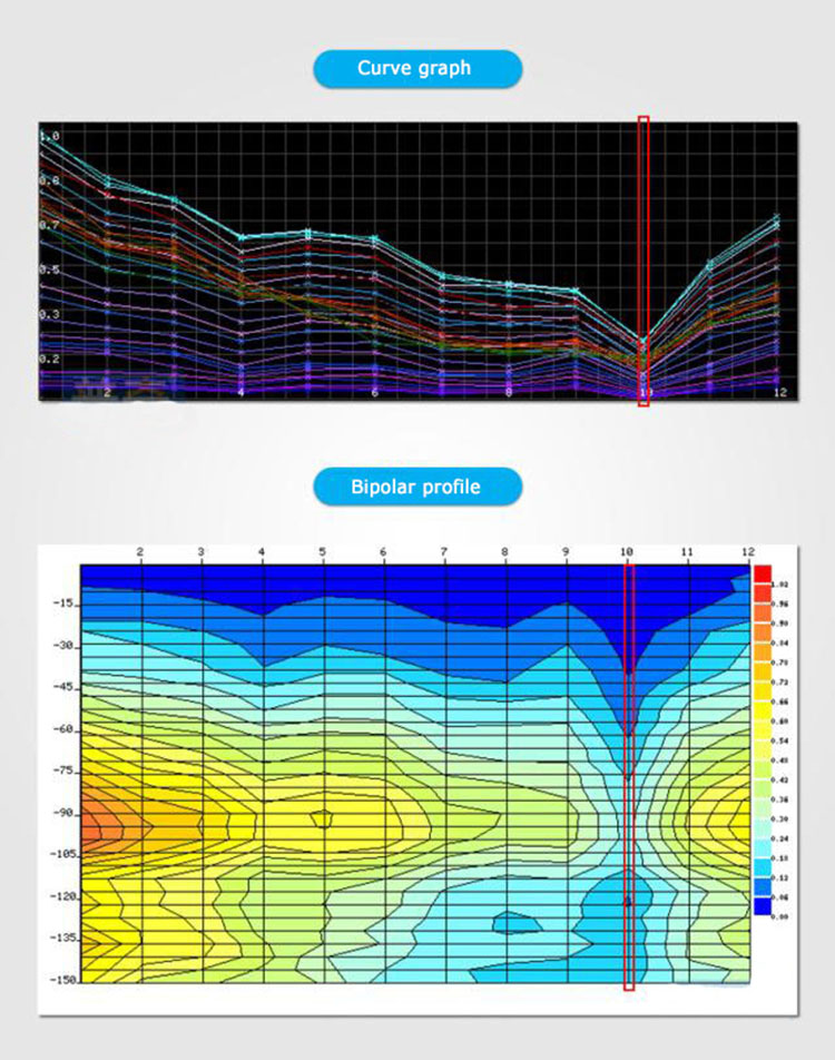
PQWT-TC150, graph and profile
The theoretical basis and design principle of the natural electric field geophysical instrument are described. According to the electromagnetic field theory, the geoelectric field electric field signal with multiple frequency points is designed and selected to be used to qualitatively understand the observation scheme of the typical structure of the underground geological body. The weak signal detection technology is adopted in the design, and the weak audio earth electric field signal is amplified, filtered, frequency-selected, integrated, and signal-converted into digital signals for analysis.
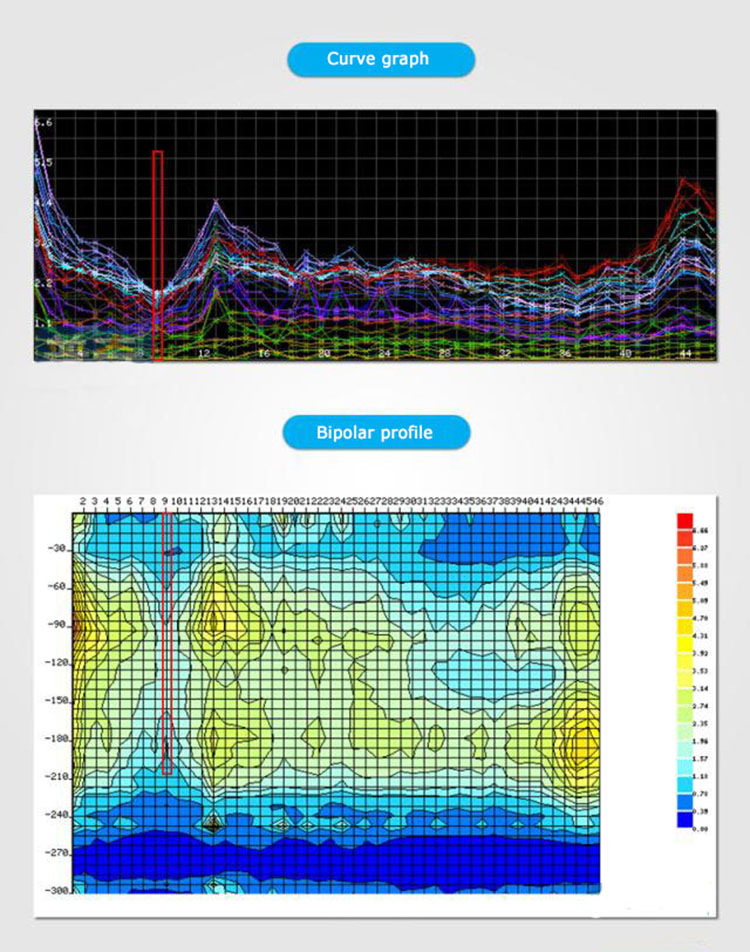
PQWT-TC300, graph and profile
The instrument can observe electric field signals at multiple frequencies, and utilizes a variety of reliable techniques in hardware design and software development to enhance the anti-jamming capability and system stability. The instrument adopts multi-channel multi-mode data acquisition, and automatically analyzes and processes the collected data, saves the data in real time and draws a graph, and finds the broken belt through the graph.
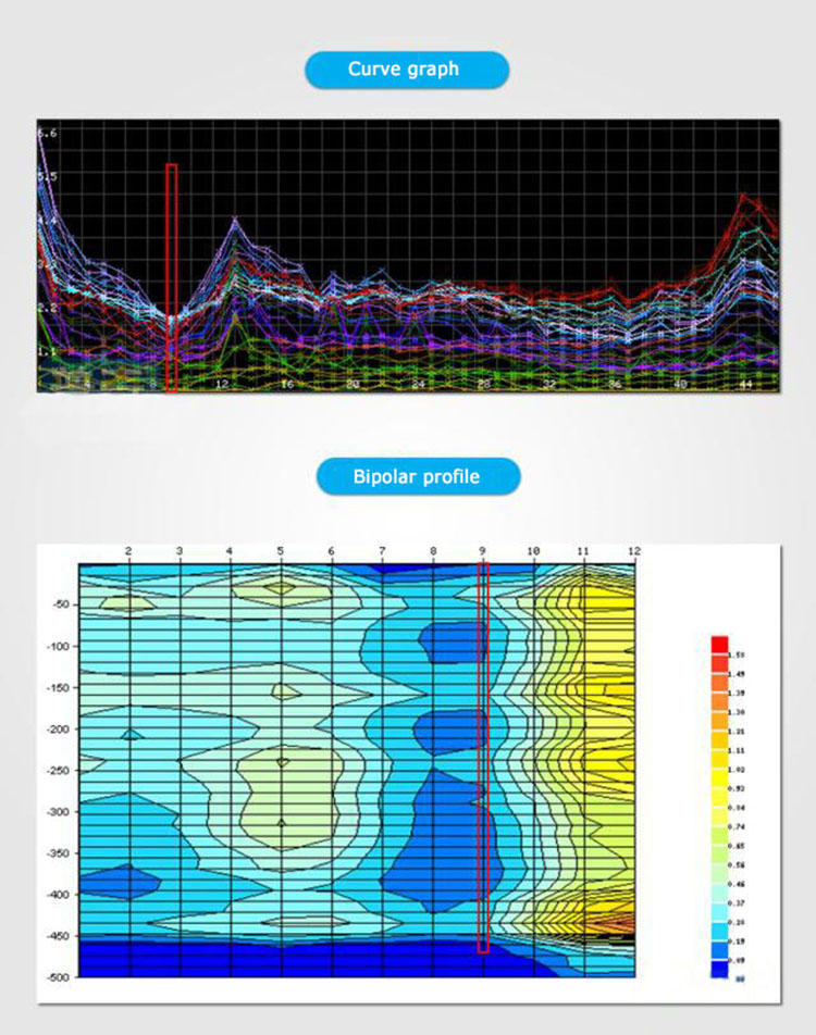
PQWT-TC500, graph and section
PQWT-TC series automatic mapping water finder is based on the earth electromagnetic field as the field source, based on the difference of conductivity of different geological structures in the ground, by measuring the variation law of electric field components at different frequencies, to study the geological structure and changes, science The search for geological structure changes in groundwater resources is shown in real time through a graph. A simple one-button operation automatically generates geological profiles to get rid of cumbersome computer graphics. At the scene, the geological structure can be quickly understood through the automatically generated graphs and profiles, and the specific information such as aquifers, fissures, faults, and caves can be analyzed. The instrument is widely used in different terrains such as plains, hills, mountains, plateaus, basins, etc. Structural changes are made to determine well location, aquifer and aquifer depth.
Through the comparative analysis of field work examples, the natural electric field frequency selector can reflect the geological information within a certain depth of the underground, and can be used for geological minerals, engineering geophysical exploration and rapid water resources survey.

© Shandong China Coal Group. © 2017
Address: No. 11, North of Kaiyuan Road, High-tech Zone, Jining City, Shandong Province, China
sales@chinacoalintl.com
Executive Editor: Zhang Wen / Editor: Linda Zhang