
market@chinacoalintl.com
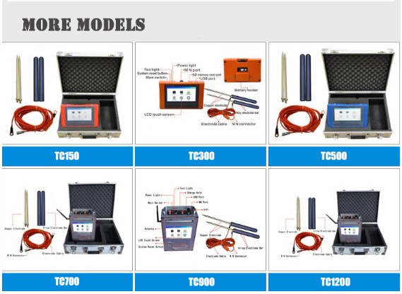
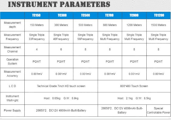
How to increase the waste detector success rate of finding water?First you should choose a high quality water detector,and then we have summrized the following points for your reference!And our water detector models are as follows:

1, PQWT series water detector to start the first test, why should I delete the retest?
The China Coal series of geophysical probes is the latest intelligent frequency selection technology developed in China. Generally, when the first point is first tested, the frequency parameters will be automatically adjusted according to the site environment. There may be instability. It is recommended to save and save again after measurement.
2. How to make the same section repeat measurement image response consistent?
The same section repeats the measurement direction, the MN line spacing, the dot pitch, and as close as possible, so that the repeated measurement images are consistent. If the image display is abnormally large, check for abnormal changes caused by interference factors such as wires, transformers, and large mechanical operations. If there is no interference or a large abnormality, you can choose to use the PQWT series of water detector to solve this problem.
3. How to arrange the dot pitch and the pole pitch? What effect does the dot pitch and pole distance have on the measurement results?
The point size is generally determined according to the size of the measured target. The larger the target is, the larger the distance is, and the smaller the target is, the smaller the distance is. For small anomalies such as dyke leakage and fissure water, you can choose a distance of 1 m or less. For example, if you are measuring the groundwater with a pebble layer or a large amount of water, you can choose a larger distance measurement (5-10 m) to avoid water finding. Prospecting of water and minerals.
The smaller the pole distance (length of MN line), the weaker the received signal, and the greater the interference, especially the electric field strength of the measurement area is small (the overall value of the measurement data is below 0.1). The length of the MN line can be appropriately increased to obtain more stability. Data, generally choose 10-20 meters is better
4. Why do some blue areas in the profile show water, and some blue areas do not produce water?
We all understand that the blue region of the profile represents the relative minimum or maximum resistivity of the entire profile, rather than representing water. Even in the non-aqueous formation, even the blue region (resistivity relative minimum or maximum) represents only the formation. Resistivity, not water, is often a greater chance of water in an aquifer. Of course, attention should also be paid to the water-bearing conditions such as the aquifer, the fracture layer, the cave or the fault, the fissure, etc. in the formation. If the local structure itself is easy to enrich water, the blue area on the structural belt is often easy to effluent.
5. Does the aquifer on the map only look at the blue area?
Not necessarily, rocks with large water permeability and large gaps, as well as pebbles, coarse sand, loose sediments, cracked rocks, and karst-developed rocks can all be aquifers. Water is low-resistance, and the rock density and resistivity in the aquifer can be unknown high or low. The geological conditions in different regions are different, which will cause different color reactions in the aquifer. The blue to yellow layer may be aquifer. Color, can only say that the water-rich rock formation area generally looks at the blue area. Therefore, it is best to collect local hydrogeological information before using the China Coal Water detector. If possible, do more experiments in the local known water wells to find out the characteristics of the local aquifer. It is better to use the water detector to guide the well.
6. What is the impact of the small number of measuring points causing the line to be too short?
The Chinese coal water detector can automatically map at least 6 points. If the distance is too small (assuming 1 meter), the line will be too short, reflecting less geological information. It is difficult to comprehensively analyze the underground geological conditions, which is easy to cause. Wrong judgment. The longer the line is, the more the reaction information is. The probability of increasing the success is generally recommended to be 10-20 points or more.

7. Can I measure after the rain (ground wet)?
Whether it is a natural electric field instrument or an artificial electric field instrument, when the ground is wet, the ground will form a low-resistance shield, which will affect the measurement depth, but the same profile humidity has little effect on the natural electric field instruments, but for the artificial electric field. Class instruments have a large impact.
8. What is the difference between an electromagnetic probe (no need for a wire) and an electrode measurement?
The position of the measuring point of the electromagnetic probe is directly below the probe; the position of the measuring point of the electrode rod is the center point of the MN electrode rod, the electromagnetic probe is obtained by measuring the magnetic field and converted into an electric field signal, and the electrode rod is directly obtained by measuring the electric field signal to obtain the resistivity. . In some areas, there is a diametrically opposite abnormal reaction.
9. What functions must the phone be turned on during measurement?
The Bluetooth function needs to be turned on, and the mobile phone traffic is not consumed when measuring. The Chinese coal water detector is like this
10. How to deal with wires, high-voltage lines, network cables, underground pipes, metal objects, etc. when measuring? What is the interference with the measurement results?
It is best to stay away from high-voltage lines, wires and other power facilities on the ground, especially the high-voltage lines are better than a few hundred meters away. If you can't move away from the parallel wires and high-voltage lines as much as possible, and each line needs to be measured more than 2 times, look for the common anomaly area of the two color maps. Improper measurement and disposal in high-voltage lines, electric wires, etc. will result in inaccurate measurement data due to excessive electric field strength in the vicinity, and the geological information displayed by the color map is distorted, misleading the user to make a wrong judgment.
For small underground metal pipes and metal objects, it has little effect on the measurement results; for relatively large metal objects, it will form a certain low-resistance shielding for the natural field; reduce the depth of detection of the instrument. If the metal pipe is charged, electromagnetic interference will occur, causing the measurement data to be inaccurate and should be kept away.
11. What is the gap between the known wells? It is clear that there is water measured to reflect the absence of water.
Due to the influence of artificial drilling, grouting, etc., the underground geological structure has undergone major changes. It is recommended that the known wells will produce a situation that does not correspond to the original geological information. well.
12. How to interpret the intensive, loose and closed lines of the measured graph?
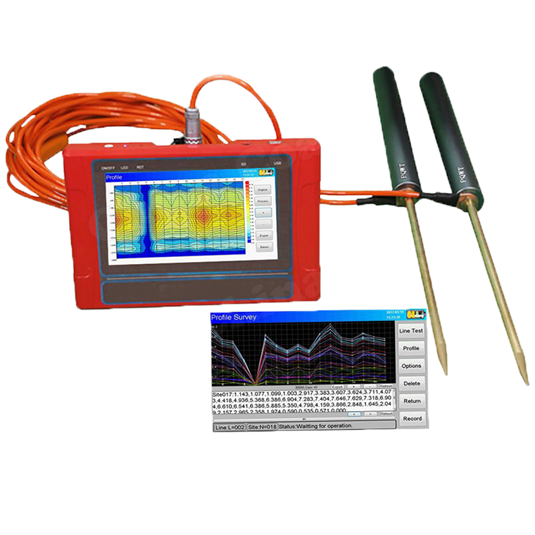
Contours are dense and indicate that the resistivity of the nearby rock formation changes greatly. Looseness indicates that the resistivity of the rock formation changes little, and the surrounding rock resistivity values are equal.
13. What is the minimum and maximum area in the profile?
The minimum value represents the low value of the resistivity of the rock formation on the section, and the maximum value represents the abnormal value of the high resistivity of the rock formation on the section.

© Shandong China Coal Group. © 2017
Address: No. 11, North of Kaiyuan Road, High-tech Zone, Jining City, Shandong Province, China
sales@chinacoalintl.com
Executive Editor: Zhang Wen / Editor: Linda Zhang